Finalrentals Blog

Published in Explore Category.
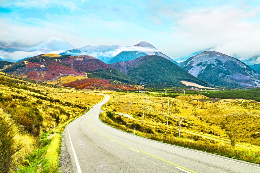
Crossing New Zealand’s South Island from coast to coast is a journey of dramatic contrasts. Few routes in the world compress such diverse landscapes into a single day of travel. Driving along the State Highway 73, officially known as the Great Alpine Highway, allows travellers to witness a breathtaking geographical transition.
The journey begins amidst the golden, sprawling Canterbury Plains on the East Coast and climbs directly into the cloud-piercing peaks of the Southern Alps. As you descend toward the West Coast, the scenery changes rapidly into lush, ancient temperate rainforests bordering the tempestuous Tasman Sea.
State Highway 73 serves as the primary and most famous mountain pass connecting Christchurch to the West Coast towns of Greymouth and Hokitika. Historically utilised as a trade route by Māori seeking prized pounamu and later developed during the West Coast gold rush, this alpine corridor remains an engineering marvel and a vital cross-country artery.
Reaching an elevation of over 900 metres, the highway provides access to soaring alpine peaks, deep river gorges, thundering waterfalls, and rare native wildlife. It stands out as an unmissable adventure for anyone seeking the ultimate New Zealand road trip experience.

Six Tips for Driving on the Great Alpine Highway
Navigating an alpine pass requires careful planning to ensure a safe and enjoyable journey. Mountain weather in New Zealand is notoriously fickle, meaning conditions can change from clear sunshine to heavy rain or snow within a matter of miles.
Choose the Right Vehicle
Selecting an appropriate vehicle is the first step to a smooth mountain crossing. The ascent up State Highway 73 features steep gradients and sweeping switchbacks that require adequate engine power. A vehicle with a reliable engine and good low-gear responsiveness helps manage steep climbs and allows for effective engine braking during long downhill stretches, such as the descent down the Otira Viaduct.
A mid-sized sedan, SUV, or compact crossover provides higher ground clearance, superior road visibility, and comfortable handling on winding mountain roads. If travelling during the winter or shoulder seasons, opting for a 4x4 vehicle offers extra traction and stability when navigating wet, icy, or slushy asphalt.
Follow the Best Schedule
Although the direct driving time across the pass is relatively short, allowing ample time is crucial. Aim to drive exclusively during daylight hours to safely navigate winding roads, narrow gorges, and single-lane bridges. Driving during daylight also ensures you enjoy the spectacular surrounding scenery without the added hazard of nighttime ice or wildlife on the road.
Check Mountain Weather
Before setting off from Christchurch, always check the latest updates from Waka Kotahi (NZ Transport Agency). Alpine road warnings, maintenance closures, or severe weather alerts can impact your itinerary. High winds, rockfalls, or heavy precipitation can cause temporary disruptions, so live highway reports are essential.
Prepare for Your Journey
Service stations are virtually non-existent along the stretch of highway between Springfield and Kumara Junction. While limited fuel is available at Arthur's Pass Village, pumps can occasionally experience outages or high demand. Fill your tank before leaving Christchurch, Rolleston, or Springfield. Additionally, mobile phone reception drops out entirely across large sections of the national park, so downloading offline maps beforehand is highly recommended.
Bring Winter Equipment
If you plan on driving along Arthur's Pass during the colder months between May and October, winter preparation is mandatory. Temperatures frequently drop below freezing, creating black ice on shaded corners. Snowfall can cover the summit quickly, and carrying snow chains is often legally required or mandated by rental car agreements. Ensure you know how to fit snow chains to your specific vehicle before heading into the mountains, and keep warm blankets, water, and extra food in the car.
Look Out for Kea Parrots
Arthur's Pass National Park is home to the kea, the world's only alpine parrot. Renowned for their intelligence and cheeky personality, these naturally curious birds frequently inspect parked cars, nibbling on rubber window seals and wiper blades. While encountering a kea is a highlight of the trip, never feed them under any circumstances. Human food is toxic to kea, and feeding them alters their natural foraging habits. Keep your car windows rolled up when unattended to prevent them from climbing inside.

Drive Coast-to-Coast on the Great Alpine Highway
The drive along Arthur’s Pass offers a continuous progression of scenic highlights. Structuring your day with well-timed stops turns a simple drive into an immersive alpine exploration.
Stop 1: Christchurch and Springfield
Leaving the urban fringe of Christchurch, the highway stretches across the vast, flat Canterbury Plains. Surrounded by manicured farmland and framed by the distant wall of the Southern Alps, the road leads toward the foothills. The small town of Springfield serves as the traditional gateway to the pass. Famous for its giant pink doughnut statue, installed for The Simpsons movie, the town is the ideal spot to buy hot coffee, check fuel levels, and prepare for the alpine ascent.
Stop 2: Steep Roads of Porter's Pass
Shortly after Springfield, the flat plains give way to steep, winding inclines as State Highway 73 tackles Porter's Pass. Rising to an altitude of 945 metres, this section offers the first dramatic taste of high-country driving. The landscape shifts dramatically from green pastures to wide-open tussock lands framed by bare mountain ridges. Paved slow-vehicle turnout bays are frequent along this stretch, allowing drivers to maintain a comfortable pace without obstructing local freight traffic.
Stop 3: Castle Hill Conservation Area
Located roughly an hour and a half from Christchurch, Castle Hill Conservation Area is one of the most surreal natural landmarks in New Zealand. Massive, weathered limestone boulders rise dramatically out of rolling green hills, resembling the ruins of an ancient stone castle. A gentle ten-minute walking track leads from the car park into the heart of the stone labyrinth. It is a world-renowned destination for rock climbers, as well as a memorable filming location featured in The Chronicles of Narnia: The Lion, the Witch and the Wardrobe.
Stop 4: Cave Stream Scenic Reserve
Just a short drive past Castle Hill lies the Cave Stream Scenic Reserve. The reserve features striking limestone cliffs and a deep gorge carved out by water. Experienced and well-equipped cavers visit to walk through the 594-metre underground limestone cave, but even from the surface, the reserve offers impressive gorge views and walking tracks suitable for a quick leg stretch.
Stop 5: Lake Pearson and Waimakariri
Continuing west, the highway meanders alongside the tranquil waters of Lake Pearson. On calm days, the lake acts as a flawless mirror, reflecting the surrounding mountain peaks and tussock slopes. It is an ideal spot for photography, bird watching, or a quiet picnic along the shore. Further along, the road follows the vast, braided riverbed of the Waimakariri River, where snowmelt flows down toward the Pacific Ocean.
Stop 6: Arthur's Pass Village and Park
Nestled deeply within the Southern Alps, Arthur's Pass Village serves as the central hub for the national park. Originating as a base camp for rail and road workers in the late nineteenth century, the village retains a rustic alpine charm. Stop at the Department of Conservation Visitor Centre to view historic exhibits, check weather forecasts, and gather track information. The village is also the starting point for the Devil's Punchbowl Waterfall Track. This popular one-hour return hike ascends through native beech forest and over wooden bridges to reach the base of a roaring 131-metre waterfall, where mist sprays over the viewing platform.
Stop 7: Otira Viaduct and Lookout
Shortly after leaving the village and passing the summit, the road reaches the Otira Viaduct. Completed in 1999, this 440-metre elevated highway span was constructed to bypass a notoriously unstable section of gorge prone to severe rockfalls and avalanches. Pulling into the Otira Viaduct Lookout provides a panoramic view of this civil engineering achievement as it curves gracefully above the dramatic canyon. This lookout is also one of the most reliable places to spot wild kea perched on the barrier rails.
Stop 8: Descent to the West Coast
Past the viaduct, the road descends steeply into the Otira Gorge, where the climate and vegetation transform instantly. Dry mountain tussock yields to thick temperate rainforests laden with ferns, mosses, and soaring podocarp trees. The highway follows the Taramakau River as it flattens out toward Kumara Junction. From here, drivers can head north to Greymouth or south to the coastal town of Hokitika, completing an extraordinary cross-country voyage to the edge of the Tasman Sea.

Frequently Asked Questions on the Great Alpine Highway
How long does it take to drive along the Great Alpine Highway? Direct driving between Christchurch and Greymouth takes around 3 to 3.5 hours for the 245-kilometre journey. However, you should allow 5 to 7 hours to enjoy the scenic lookouts, short walks, and historic stops along the route.
Is the mobile network reliable along the Great Alpine Highway? Mobile signal drops out across large sections of the mountain pass, making offline maps essential. Service stations are practically non-existent between Springfield and the West Coast, so you should fill your tank before starting the climb.
Is it hard to drive along the Great Alpine Highway with a standard car? State Highway 73 is fully paved and well-maintained, making it accessible for standard cars and campervans. Drivers should simply take care when navigating steep mountain inclines, tight curves, and single-lane bridges.
Can I complete the drive along the Great Alpine Highway within a day? Yes, driving from Christchurch to Arthur's Pass Village and returning the same day is a popular day trip option. However, continuing all the way to the West Coast is best enjoyed as part of an overnight road trip itinerary.
What should I do if I meet kea parrots along the Great Alpine Highway? You should admire these curious alpine parrots from a distance and keep your vehicle windows closed when parked. Never feed kea under any circumstances, as human food severely harms their natural health and foraging habits.
Rent a Car to Explore the Gems of the Great Alpine Highway
Driving along Great Alpine Highway stands as one of the world's truly magnificent road journeys. Connecting the eastern and western coasts of New Zealand’s South Island, State Highway 73 delivers a rich tapestry of landscapes, from flat farmland and limestone boulder fields to towering alpine peaks and ancient coastal rainforests. The variety of scenery, combined with accessible day hikes and iconic wildlife encounters, makes this alpine road trip an absolute priority for any visitor.
To experience this alpine crossing with complete independence and flexibility, consider renting a car in New Zealand. Having your own vehicle allows you to set your own pace, linger at mountain lookouts, and discover hidden gems across the Southern Alps. Book your rental car, pick up your keys in Christchurch, and set out on an unforgettable coast-to-coast adventure across Arthur's Pass.